Main menu: Home Features 3D Maps User Guide Support Buy Now Disused Tube Blog

The Boundary of Zone 2 and 3

13th November 2015
 

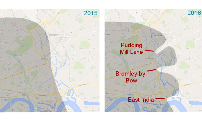
With the announcement of the new fares for 2016 by TfL, they also confirmed something that has been planned for while – Stratford station is being changed from being Zone 3 only, to be a boundary Zone 2 & 3 station.

But here’s the bit that we didn’t know about – several other stations in the area are also becoming boundary 2 & 3, that were previously just zone 3 – basically following the DLR line south, those being – Stratford International, Stratford High Street, Abbey Road, West Ham, Star Lane and Canning Town and all changing too.

But the really interesting thing, is that the stations that are currently boundary Zone2/3 in the area don’t appear to be changing.  Hang on, what! Yes – they will ALSO be boundary Zone 2 and 3.

And that got us thinking.  If you look at the boundary zone between 2 and 3 in a geographical way it’s currently a nice smooth curve, but when the changes happen, it will change to look like, well … this!

The Boundary of Zones 2 and 3 in the east

The Boundary of Zones 2 and 3 in the east


Official Walking Map

10th November 2015
 

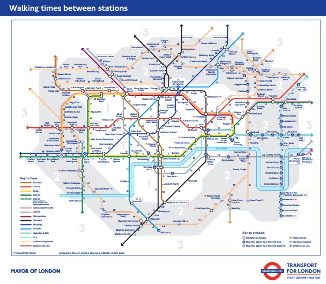
Tucked away on the TfL website since last week is a new Tube map … with walking times. Looking extremely similar to something that was produced independently during the last round of Tube strikes, this is the first time that TfL have ever produced their own official walking times map.

Note that it only shows walking times between stations that you can get a train between, and doesn’t show handy walking connections – e.g. between Aldgate and Aldgate East. Nevertheless it’s an interesting new map to come out, and might make you realise that a journey could be quicker if you walked it rather than enter a station and wait for a train…

Walking times

Walking times


Finsbury Park Gateline

5th November 2015
 

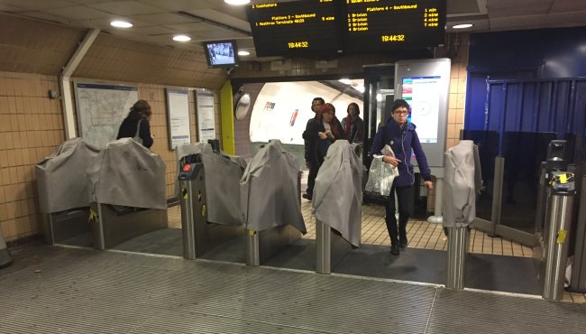
Whilst the BBC speculates that Night Tube may not happen altogether, we can bring you more exciting news – Finsbury Park station is finally getting a gateline!

It will therefore lose its tag of ‘busiest station on the network without ticket barriers’, but we bet it makes a difference to revenue figures.  The main entrance (pictured below) as well as the Wells Terrace and Seven Sisters Road entrance are all getting ticket barriers. They’ve been installed, but not switched on yet – but expect it to be during November.

Finsbury Park Gateline

Finsbury Park Gateline


New Tram platform at Wimbledon

3rd November 2015
 

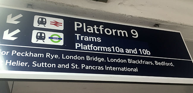
After three months of work, during which Trams had been terminating at Dundonald Road and not going Wimbledon, the station reopened yesterday on Monday (OK, actually it was open late on Sunday) for trams to stop there again, and there’s a brand new platform.

Platforms 10a and 10b

The work that has been done is a ‘runaround’ the same as how Overground trains stop at Clapham Junction in that the second platform is now behind the first one at Wimbledon station, and they’re now called platforms 10a and 10b.

Double track

Double track

This means that come the new year, there will be an extra four trams per hour running to the Wimbledon branch – twelve instead of the current eight which is a nice bonus to the capacity on this part of the line.

It goes quite a way ...

It goes quite a way …

We’ve updated out Station Master 3D map of Wimbledon to reflect this, and we just might be working on something that’s Tram specific too! Watch this space …


Dagenham East, heading West

28th October 2015
 

2015-10-27 15.43.00We found ourselves out the eastern of the District line yesterday for a non-Station Master task, but whilst we’re passing through stations we always find ourselves continually on the look out for anything that’s new or changed, or that perhaps we didn’t spot the first time round!

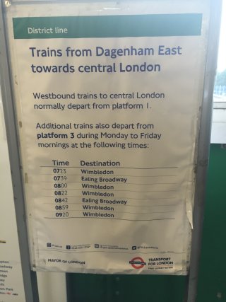
We found this poster therefore, in the ticket hall at Dagenham East – where our travel tip recommends that some trains can start here and leave from Platform 3, and not Platform 1 which is where most westbound services start – except now there’s a poster up giving the exact times which is dead handy to know.

0723, 0729, 0800, 0822, 0842, 0859 and 0920 are the times of scheduled services that start here and head west into central London – which is also handy to know if you’re a commuter from Dagenham Heathway, Becontree or Barking heading into town because by getting the train that starts from here it’ll be quieter, and much more likely that you’ll get a seat … always good to know.


How Many Step Free Stations Are There?

26th October 2015
 
Step free

Step free

When the Greenford Inclinator (sorry, Incline lift) opened on the Underground network last week, the official line from the press release was that there are now 67 Underground stations now have step free access.

As accessiblity is something we’re quite keen on getting right in Station Master, we thought we’d have a quick count and check, because it felt like it might be slightly more.

Here’s what we found when looking at the official TfL Step Free Tube Map.

The Underground has 69 fully step free stations. They are:

Acton Town, Barking, Bermondsey, Blackfriars, Brixton, Canning Town, Caledonian Road, Chalfont & Latimer, Canada Water, Canary Wharf, Chesham, Chorleywood, Dagenham Heathway, Earl’s Court, East Ham, Edgware, Epping, Elm Park, Farringdon, Finchley Central, Fulham Broadway, Golders Green, Green Park, Greenford, Hainault, Hammersmith D&P, Hammersmith C&H, Harrow & Wealdstone, Hillingdon, Heathrow 123, Heathrow 4, Heathrow 5, Hounslow West, Hendon, High Barnet, Hounslow East, Kensington (Olympia), Kingsbury, Kings Cross, Kilburn, Kew Gardens, London Bridge, Morden, North Greenwich, Oakwood, Paddington, Pinner, Richmond, Roding Valley, Stanmore, Stratford, Sudbury Town, Southfields, Southwark, Tottenham Hale, Upney, Uxbridge, Waterloo (Jubilee), Upminster, Wembley Park, Wembley Central, West Finchley, Westminster, West Ham (Jubilee), Willesden Junction, Wimbledon, Woodford, Wood Lane, Woodside Park,

So that’s two more than the official TfL count of 67 – why the difference? Well, that could be because they might Hammersmith as being one station, where as we would argue that it’s two separate stations. Or consider that Waterloo is only fully step-free accessible to the Jubilee Line … hang on, there’s a strange anomalie in that due to the Jubilee Line lifts you can get to the southbound platforms step free at Waterloo Bakerloo, but all the would let you do is make a cross-platform interchange at Lambeth North, and head north up the Bakerloo and you could go to Baker Street and change to the northbound Jubilee Line, but the earliest a wheelchair users could get off the Bakerloo Line would be at Willesden Junction.

One Direction (Not the band)

One Direction (Not the band)

But that brings to our attention other stations that are like this – where you can get access to an Underground train, but admittedly (due to the configuration of a station) only in one direction. Which is the following stations:

Amersham, Barkingside, Borough, Cannon Street, Debden, Elephant & Castle, Euston Square, Liverpool Street, Rickmansworth, Ruislip, South Woodford, Theydon Bois, Waterloo (Bakerloo) West Brompton.

That’s 14 more stations, except Waterloo is a repeat of the Jubilee Line, so it adds 13 more to the total – meaning that there are 82 stations out of 270 on the Underground that have step free access, that’s 30.3%, just under a third.

Want to make things a bit more tricky to get your head around? Of course you do… The Tube Map should no longer really be called that as the real count of numbers of stations on the map is now at 408, a third of which are no longer Underground services, it has Overground, DLR and TfL Rail too. The DLR is of course totally step free from it’s construction but how is the Overground holding up?

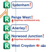
We’ve counted 45 Overground stations that are fully accessible step-free in both directions, they are:

Anerley, Acton Central, Brockley, Bush Hill Park, Caledonian Road and Barnsbury, Camden Road, Canonbury, Cheshunt, Chingford, Clapham Junction, Carpenders Park, Crystal Palace, Dalston Junction, Denmark HIll, Edmonton Green, Euston, Emerson Park, Enfield Town, Forest Hill, Gospel Oak, Hampstead Heath, Highams Park, Highbury and Islington, Honor Oak Park, Harringay Green Lanes, Hackney Wick, Homerton, Hackney Central, Haggerston, Hoxton, Imperial Wharf, New Cross Gate, New Cross, Romford, Queens Road Peckham, Shepherds Bush, Shoreditch High Street, South Acton, Sydenham, Upper Holloway, Watford Jcn, Walthamstow Queens Road, Walthamstow Central, West Croydon.

Kew, Richmond, Olympia, West Brompton are also step free, but are shared with Underground stations, so have already been counted.
Overground

Overground

The Overground also has six stations where step-free access is available in one direction only, namely:

Kensal Rise, Headstone Lane, Hatch End, Penge West, Norwood Junction, Hackney Downs

And as it’s on the TfL services map with its 408 stations we can’t ignore the step-free TfL Rail services too, which are: Romford (also Overground), Chadwell Heath, Brentwood, Shenfield

So, in summary…

There are 69 (not 67) step-free station on the Underground. 82 if you include the the ones which have it in one direction only. Plus the Overground brings 51 more to that total, Tfl Rail adds three more, and of course don’t forget the 45 stations on the DLR, that brings our grand total up to … 99 stations out of the 408 on the map (which is 24%, call it a quarter) that have step-free access.

We’ll update this post as more get added to the network, Tower Hill and Vauxhall should be getting their lifts next …
Tourist Map

24th October 2015
 

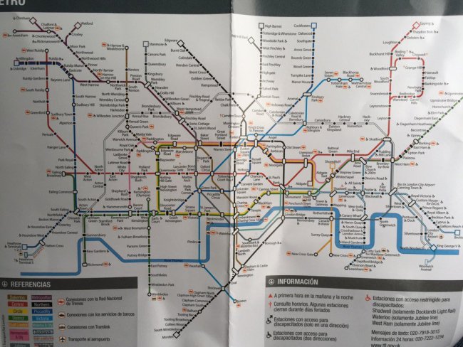
Some visiting friends from Spain popped over to London recently, and with them they brought an old travel guide of London that they had on the shelf at home, which contained a map of the London Underground, “We can use that!” they thought. Here’s the map …

Spanish Map 1

Spanish Map 1

Straight away you can see from the lack of Overground that this is an old map, but that the presence of the North London Line which goes all the way down to to North Woolwich  which closed in 2006, shows that map they’re using is at least ten years old!

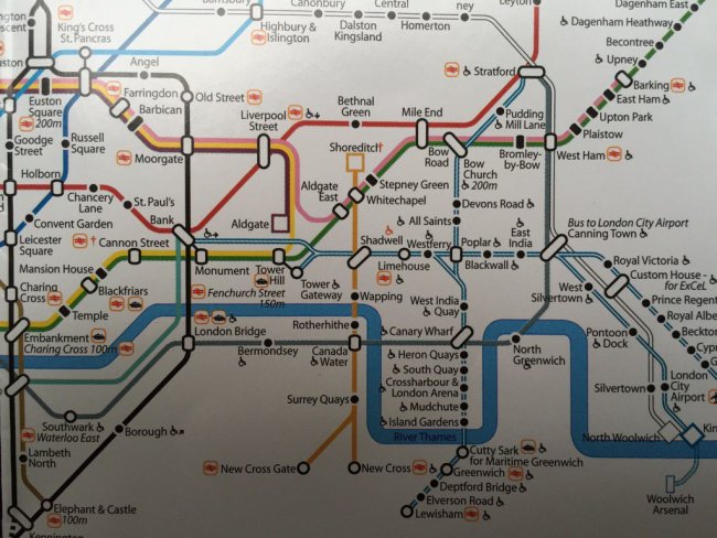
The station ‘blobs’ are an intruiging design themselves, as are the wide white connector blobs which is something that we’ve not seen before.  Here’s a zoomed up picture of the central area:

Spanish Map 2

Spanish Map 2

Here you can see some rather wonderful square-shaped terminus symbols (at Aldgate and Shoreditch) which are most unusual.  What we do like though is it show how the Tube map might look if the blue-wheelchair-blobs were removed, and the wheelchair symbol just used next to the station name instead as some suggest.  It looks a bit cluttered though when you realise that every station on the DLR has it.

A label saying ‘Charing Cross 100m’ rather nastily crashes into the Thames, and best of all is the most religious station on the network – look between Leicester Square and Holborn and you’ll discover Convent Garden !


Incline Lift

21st October 2015
 

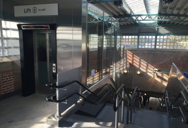
So that new ‘inclinator’ at Greenford station? Don’t call it that! Even though the one down at the Millennium Bridge is called that, this one is being called an ‘incline lift’ and is the first one ever on the Underground, and we think in fact the first at any UK railway station.

It brings the total of step-free stations on the Underground up to 67 – that’s the official total anyway, as there are 14 more stations that we can think of that have step-free access but in one direction only. And this is just Tube stations, all of the DLR is step-free of course, and there are many Overground stations too which aren’t including in that total of 67.

It’s worth nothing that the staircase and escalator are new too – not just refurbished, and even the toilets on the platform are now unisex, and accessible by wheelchair users too. It’s an all-new shiny Greenford station!

Greenford

Greenford


Inclinator at Greenford

19th October 2015
 

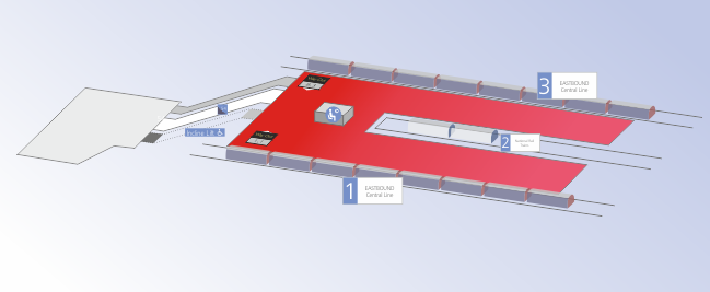
And following on from yesterday, we’ve a nice swish updated map for Greenford too … which has now lost its wooden escalator (the last on the system) and has had an inclinator installed instead.  So our new 3D map reflects this.

New 3D map for Greenford

New 3D map for Greenford


New Moorgate Map

17th October 2015
 

We’ve got a new update of Station Master coming next month, with lots of updated data, and maps – some of which have just been polished to look better, others where things are new and have significantly changed on the network,

It includes the sub-surface platforms at Moorgate, which (due to Crossrail works) have changed quite significantly with a new access corridor and steps down to the platforms completely changing what was there before.

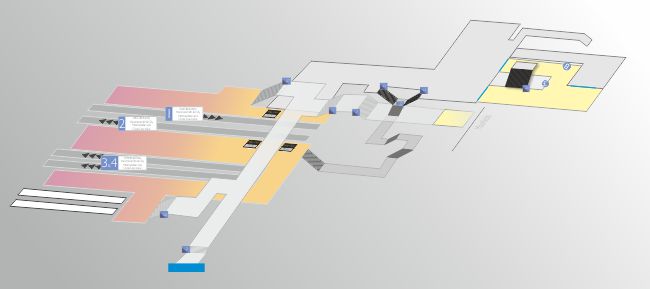
Obviously we’ve been along to map it out and draw the 3D map as to how it now looks!

New Moorgate Map

New Moorgate Map