Station Master Geoff has written and produced an article and video for Londonist speculating on what might happen in May of this year, when new Overground lines are added to London’s transport network …
Map
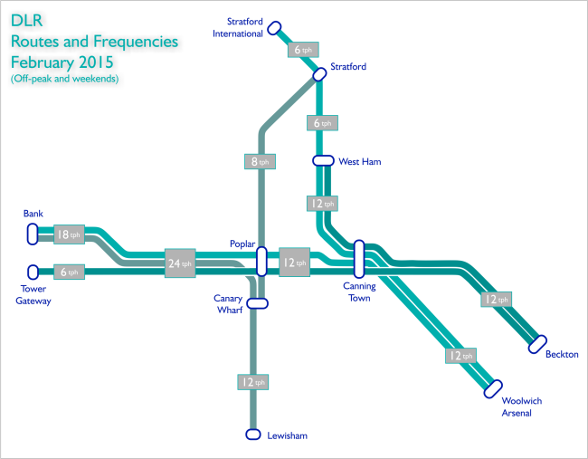
New DLR Map
Well, we say ‘map’ it’s a diagram of where the services now run, and how many trains per hour (tph) you can expect on that branch.
Note this is for off-peak and weekend services, during the peak hours – there are a few more trains on the network and they get extended and do go to a few more places, but this now gives you an idea of the new setup, including a new strange West Ham terminating train …
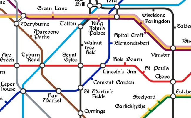
Ye Olde Tube Mappe
Matt Brown from the Londonist website has released this today – a fun Medieval Tube map, from a time ‘Utterly untroubled by signal failures; and a time when you might be imprisoned for swiping an Oyster‘
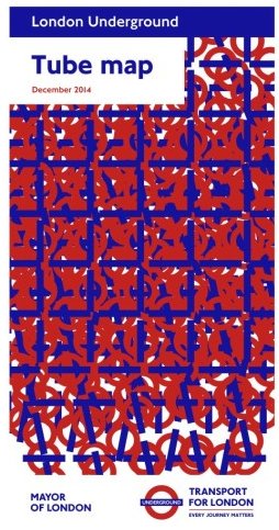
New December 2014 Tube Map
So have you got your hands on the new Tube map yet? Art on the Underground commissioned French artist Daniel Buren to create the artwork for the twenty-first edition of the Tube map cover series, called ‘From a Single One to Millions‘.
It’s a blend of many roundels all mixed together, and we were surprised when we thought about it that the roundel symbol hasn’t actually appeared in any of the previous AotU series of map covers.
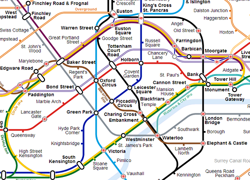
Map-design-wise itself, Embankment is now open again on the Northern and Bakerloo lines, the Central Line is NOT stopping at Tottenham Court Road (as it won’t be from January 3rd 2015), and the Covent Garden dagger gives a warning as to the fact that it’s going to be exit only again for most of 2015 as they replace the other pair of lifts.
The new station building and ticket office at Tottenham Court Road for the Northern Line opens on January 12th, and they’ve built lifts at the new station too – so how long before a ‘step free’ wheelchair blob appears for TCR on the map?
Diamond Geezer has some further thoughts here,
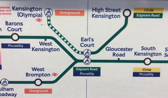
Olympia – HSK Shuttle
Something we’ve only just noticed on carriage maps of District Line trains is the way that the shuttle service is shown between Olympia and High Street Ken.
Obviously trains to/from Olympia are very infrequent and are thus shown as a dotted line, but why then does the in carriage map show the ‘shuttle’ service as being a solid line to High Street Ken?
Yes, there are regular Wimbledon to Edgware Road services (as well as the Circle) which makes this a non-restricted service, but following the logic of the carriage map here, it’s clearly showing a shuttle service between Olympia and HSK, in which case shouldn’t the green line between Earl’s Court and HSK also be a dotted line instead of a solid one?
Unofficial Crossrail Map
Ian over at RandomlyLondon has found a Reddit user that’s created an unofficial tube map of London, including what it will look like once Crossrail is in place.
Click on the map for a link to the full sized version.
Two Bakerloo Extensions
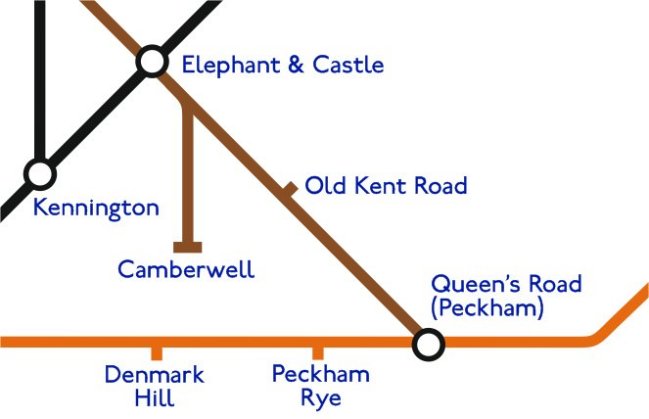
Bakerloo Line to Camberwell? It’s been talked about for years – going back to the 1930’s. But an intriguing article by the London SE1 community website quoted Boris Johnson as saying “Standby for amazing news” with descriptions of two routes – one down to Camberwell, but another down to Peckham.
We knocked together a quick altered tube map to envisage what it might look like.
More Rezoning
After the possibility of the new Northern Line stations being in Zone 1, it was revealed by TfL yesterday that the three Stratford stations (Stratford, Stratford High Street and Stratford Non-International) would be moved from Zone 3 to become boundary Zone 2/3 instead meaning small savings for anyone travelling between Zone 1 and these stations.
Diamond Geezer has the full comprehensive breakdown here, but for us it’s a chance to have a look at the topological zone map again, to see yet another ‘bump’ created on the map of where the zones really lie topologically speaking. And it’s quite ugly…
New to Zone 1?
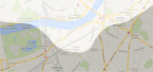
Station Master Geoff, you may recall, drew this map for Londonist a while back which shows the real geographical boundaries where the zones are in London.
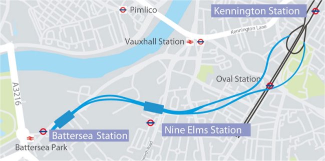
In a discussion we were having over the weekend though, it transpires that the two new planned Northern Line stations at Nine Elms and Battersea may be placed into the Zone 1 area – a bit like how Shoreditch High Street was shoehorned into Zone 1, even though it should have been in Zone 2.
So here’s how the ‘zone map’ would look distorted if that were the case, with a large ‘bump’ of Zone 1 white stretching south to accommodate the two new stations … if it were to happen.
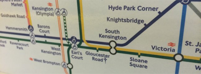
Gloucester not on the map
Finally .. finally! We’ve seen some carriage tube maps where Gloucester Road on the Piccadilly line isn’t marked. It seems that Embankment on the Northern/Bakerloo was struck off the map before the work even started, but poor old Gloucester Road on the Piccadilly has been shut for a month now, and this is the first time we’ve seen in indicated so on a map properly.
