Main menu: Home Features 3D Maps User Guide Support Buy Now Disused Tube Blog

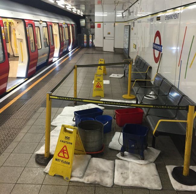
Wet Embankment

14th January 2016
 

It’s quite common to see the occasional leak at Tube stations, but when it’s at one where the land has been reclaimed back from the river, and it’s still right by the Thames, I always worry a litter harder.  The westbound platform at Embankment sub-surface has been like this for over a week now…

Ingress

Ingress


Still no lift at Vauxhall

13th January 2016
 

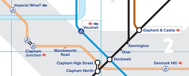
The new January 2016 Tube Map brought with it a few changes, but one of the more subtle ones was that Vauxhall now got a connector blob – sorry! I mean a ‘blue wheelchair blob’ (making it impossible to distinguish whether stations marked as such are interchange stations or not).

Vauxhall Blue Blob

Vauxhall Blue Blob

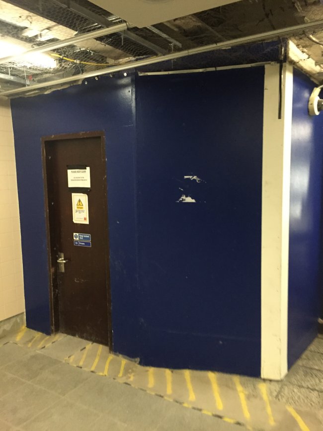
This should have meant that the accessibility count for step-free stations should have gone up to 70, except for the small matter … that the lift is not operational yet.  Down at platform level the corridor between the two platforms at the southern end is where they’re building it, and up in the ticket hall area, all there is is a big blue door (below) where it’s not finished.  We’re just wondering how long it will be in terms of time between the Tube Map saying it’s accessible, and it actually being a reality…

Lift not finished at Vauxhall

Lift not finished at Vauxhall


Express Central Line Trains

11th January 2016
 

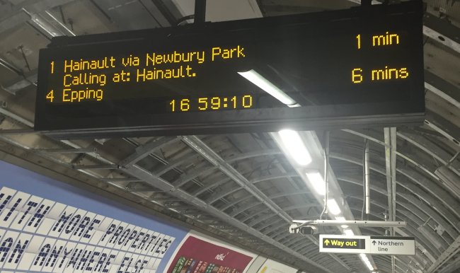
Have you seen the new express trains on the Central line? They start at the new Tottenham Court Road, and then head all the way to the end of the line without stopping at any intermediate stations…

TCRdmi1

At least that’s what the new Dot Matrix Indicator boards suggest.  If you’re a regular traveller on any National Rail service you’ll know that when ‘Calling at…’ appears beneath the destination, a scrolling list of stations then appears telling you the intermediate stopping points.

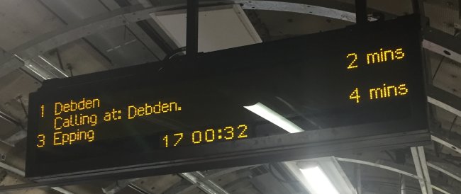
Not so with the new DMIs at Tottenham Court Road.  A train going to Epping beneath it says “Calling at : Epping’ and nothing else, thus replicating the destination that’s already shown on the line above, and doesn’t scroll with any other station names, thus possibly suggesting that the only station the next train is calling at just the station at the end of the line…

The destination of this train is ...

The destination of this train is …


Ready for the Overground

5th January 2016
 

Remember how when the Tube map changed back in May, an extra kink was put into the Central line (on the online and posted editions only) to make it Crossrail-ready? Well, something else has happened with the new January 2016 map.

(Also, let’s note the fact that Vauxhall has got a blue ‘accessibility blob’ even though the lift is not yet operational, and so the map is wrong – Vauxhall is not an accessible station)

The Tube map last year on the southern bit of the Overground around the New Cross area looked like this:
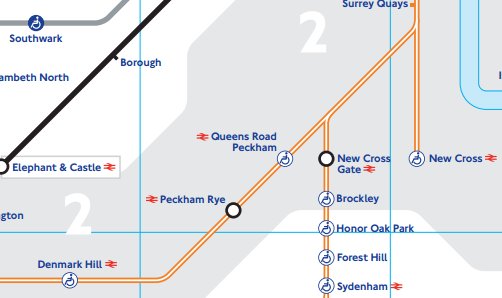
2015 Map

2015 Map


After Surrey Quays, the line went straight down to New Cross, with Clapham / West Croydon / Crystal Palace trains all following the same, then splitting with Queens Road Peckham on the Clapham branch and New Cross Gate heading straight down south.

Well, now with the new January 2016 Tube map, it’s changed and has become a ‘3-way split’, here:
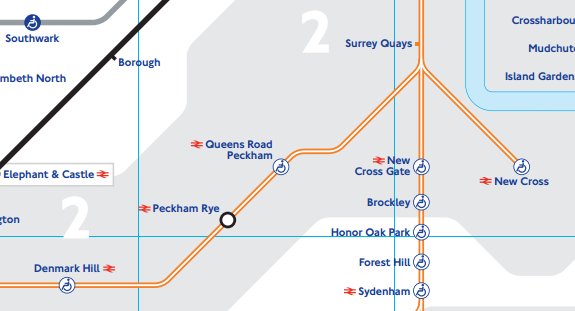
2016 Map

2016 Map


So why have they done this, you might ask?

It can only be because of a new Overground station that’s coming between Queens Road Peckham and Surrey Quays – namely Surrey Canal Road.  Well – except it isn’t any more it’s may end up being called ‘New Bermondsey‘ instead, and work was expected to have started by now, but we don’t think it has!

But that’s some forward planning by the Tube map designers to get the name of the Overground in early, just as they’ve done with moving the Central line to accomodate Crossrail when it appears on map.
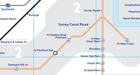
 

Or will it be called New Bermondsey?
Or will it be called New Bermondsey?

New Zones for 2016

4th January 2016
 

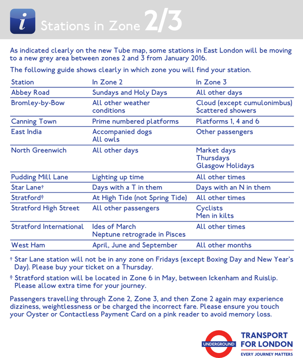
Now that a large area on the new Tube map is a Zone 2/3 blob, it’s become a little more confusing. We hope that this helps clear things up …

Zone 2/3 Guide


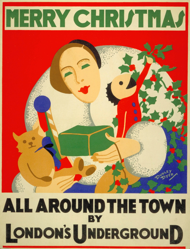
Merry Christmas!

25th December 2015
 

.. and a Happy New Year.

Underground Christmas

Underground Christmas


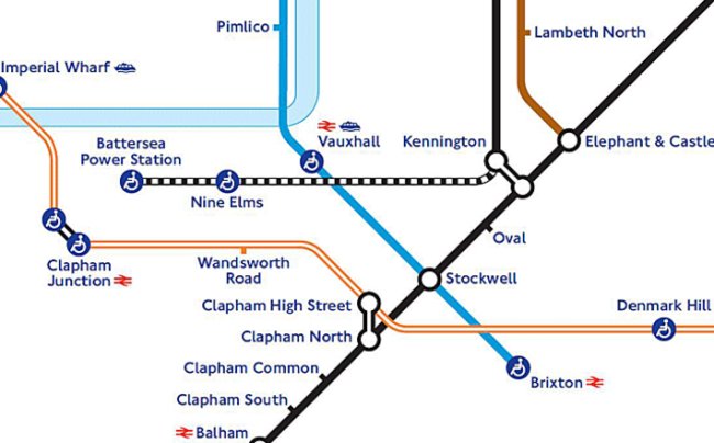
Battersea Power Station Station

23rd December 2015
 

There’s a new document on the TfL website today, talking about the Northern Line extension upon which work has started and if it all goes to plan will be complete and open by 2020.

There’s just one odd thing we’ve noticed .. and that’s the name of the two new stations. They’ve all been marked as Nine Elms and Battersea on previous mock-up maps, but now it seems as if someone’s taken the decision to call the latter ‘Battersea Power Station‘ instead. Which is great … were it not for the fact that it’s ridiculous.

Battersea Power Station itself will not longer exist by the same the station opens, so it’ll be named after something that isn’t there (even if historically it is still known), and everyone will just call what it should be called anyway, which is ‘Battersea‘.  Plus that fact that it’ll be the first tube station to have the word ‘station’ in the official names, and then you’ll be able to say in a sentence, “I’m getting the train to Battersea Power Station station”.

TfL have form for doing this though – why have a short name which fits better onto a small map, when three longer words will do instead?  We can’t have ‘Vicarage Road’ on the Met as everyone will call it – no, it’s going to be called ‘Watford Vicarage Road’ instead because we’re all too stupid to know that it’s in Watford.

So … Battersea tube opens in 2020. Please remember to call it that …

(Also if we’re being really picky, we suspect that the new Northern Line will be dug deeper than the existing Victoria Line, meaning that that here it should go under the Victoria line, not on top of it. But you know … that’s really picky).

Battersea Station Station

Battersea Station Station


Meet … Mapway!

21st December 2015
 

Our exciting festive news which we’ve been working on for a while and can now be revealed is that we’ve teamed up with the nice people at Mapway. Formerly known as mxData, you might already have one of their Apps on your phone – The Tube Map App.

We’ve teamed up with them to provide some of the data (such as exits, and 3D Maps) that’s within Station Master so that the Tube Map app can have access to it as well!

And for people that have been asking us for ages “When will your App be on Android”, the great news there is that the Tube Map App (including the Station Master data from early 2016) is on the Android platform!

There’s more over on the Mapway pages with their press release, including “One of the features we’re especially looking forward to sharing with you, is the addition of accessibility information for London Underground stations. And this won’t be your usual step-free info, that’s for sure. Thanks to Station Master we’ll have all sorts of details about accessibility for wheelchair users, people with prams and even travellers with luggage! So you have a clearer view of how easy a Tube platform is to reach, depending on the situation”

We’re also working with them on other projects in 2016, which we’ll reveal at some point, but until then have a look at the Tube Map App if you don’t already have it, and Merry Christmas from the Station Master!

Mapway

Mapway


Bank Upgrade

18th December 2015
 

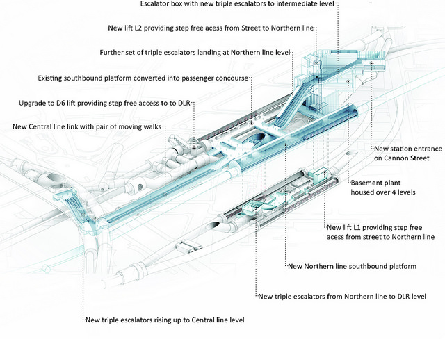
TfL announced today the go ahead for upgrading Bank station with work beginning next year in 2016. It may ‘only’ be the 4th busiest station in terms of passengers going through the gatelines, but it IS the Tube’s busiest station in terms of people going through the station as it is a major connection point.

Lifting straight from the press release, TfL are saying that “The £563m upgrade will increase the busy station’s capacity by 40 per cent, improving accessibility and reducing interchange times when it is completed in 2021. Now approved, the station becomes the latest in a series of major upgrades taking place across the Capital.”

And they’ve released a whole bunch of fancy images, the whole gallery of which you can can see on Flickr here. Now all we need is for the announcement that Camden Town has got the go ahead…

New Bank Station

New Bank Station


A Tube map made of chocolate

16th December 2015
 

Take ten people, a few tubs of Quality Street containing a few thousand brightly coloured wrapped chocolates – and you can make a Tube map out of them! Like this …