Main menu: Home Features 3D Maps User Guide Support Buy Now Disused Tube Blog

Contactless launch date

25th July 2014
 

contactlesscardToday TfL have announced that contactless payments will launch on TfL services on the 16th September 2014.

However, don’t go throwing away your Oyster card just yet as it is what it says: TfL services only and not the current contactless travel on the buses, nor (officially) National Rail services in London (the contactless pilot has worked on National Rail).

However it appears that TfL hope to have National Rail services on board by the launch date and are working with Network Rail to enable this.

Diamond Geezer has an excellent FAQ about the contactless system on his blog.


New choob

24th July 2014
 

It’s been online for ages, but I don’t think we’ve ever embedded the video to it here on the Station Master blog, so in case you haven’t seen it – is this the future of tube travel?


Two Bakerloo Extensions

23rd July 2014
 

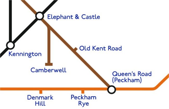
Bakerloo Line to Camberwell? It’s been talked about for years – going back to the 1930’s. But an intriguing article by the London SE1 community website quoted Boris Johnson as saying “Standby for amazing news” with descriptions of two routes – one down to Camberwell, but another down to Peckham.

We knocked together a quick altered tube map to envisage what it might look like.

Possible Bakerloo Extension

Possible Bakerloo Extension


More Rezoning

22nd July 2014
 

After the possibility of the new Northern Line stations being in Zone 1, it was revealed by TfL yesterday that the three Stratford stations (Stratford, Stratford High Street and Stratford Non-International) would be moved from Zone 3 to become boundary Zone 2/3 instead meaning small savings for anyone travelling between Zone 1 and these stations.

Diamond Geezer has the full comprehensive breakdown here, but for us it’s a chance to have a look at the topological zone map again, to see yet another ‘bump’ created on the map of where the zones really lie topologically speaking. And it’s quite ugly…

How it looks now ...

How it looks now …

How it will look in 2016 ...

How it will look in 2016 …


New to Zone 1?

21st July 2014
 

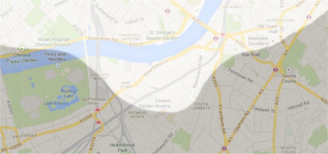
Station Master Geoff, you may recall, drew this map for Londonist a while back which shows the real geographical boundaries where the zones are in London.

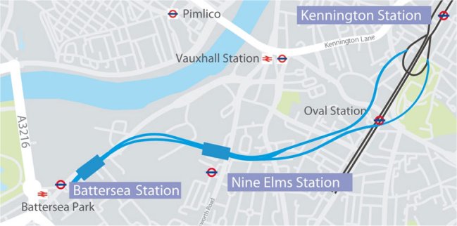
In a discussion we were having over the weekend though, it transpires that the two new planned Northern Line stations at Nine Elms and Battersea may be placed into the Zone 1 area – a bit like how Shoreditch High Street was shoehorned into Zone 1, even though it should have been in Zone 2.

Northern Line extension

Northern Line extension

So here’s how the ‘zone map’ would look distorted if that were the case, with a large ‘bump’ of Zone 1 white stretching south to accommodate the two new stations … if it were to happen.

Nine Elms and Battersea in Zone 1

Nine Elms and Battersea in Zone 1


International Platform 2

20th July 2014
 

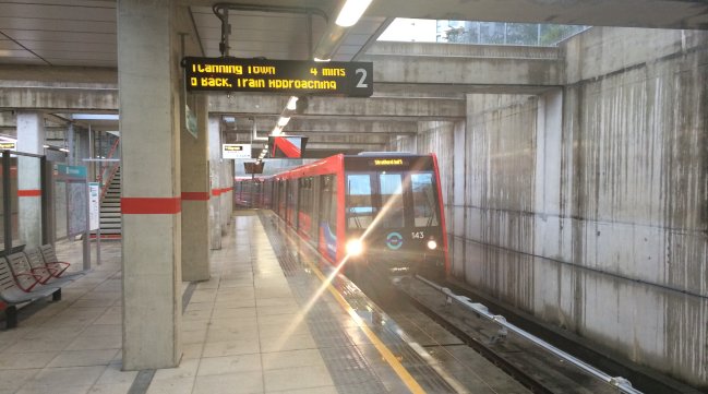
Here’s a fun anomaly that we spotted at the weekend. Every single time we have been to Stratford International on the DLR, it has only ever used Platform 1. We didn’t even think Platform 2 was in use, so it was to our small joy that we caught a train there yesterday coming in and out of Platform 2, which we were told “Does happen just once or twice a day”

Stratford International Platform 2

Stratford International Platform 2


Three Wi-Fi

18th July 2014
 

Network provider Three have announced that they are joining the ‘Wi-Fi on the underground’ party!, and that in the coming weeks those on the their network can also get free Wi-Fi at Underground stations.

Three WiFi

Three WiFi

Full announcement here.


Which Direction?

16th July 2014
 

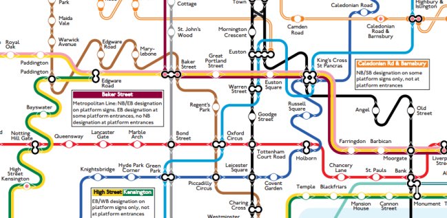
Max Roberts – best known for his many alternative tube maps that he often produces – has come up with a map that he asked us for some help with, as we had the data as to whether a station and its trains’ directions were signed as ‘Northbound’, ‘Southbound’, ‘Westbound’ or ‘Eastbound’.

So he made a map (of which only a small part is shown here, go to Max’s newsletter page for the full version and other previous maps) which indicates how it would look if the map properly adhered to the direction that the platform sign indicates.  e.g. it might say ‘Eastbound’ but on the map it’s running in a north/south direction!

Confusing? A little at first yes, but then take some time to study it and then realise for ever more so just how distorted the real tube map is!

Which direction?

Which direction?


Preferred bidder for Northern Line extension

15th July 2014
 

A tweet doing the rounds last night pointed us in the direction of the Construction Enquirer website, which was running the story that a preferred bidder for the Northern Line extension had been announced.

The project is still awaiting approval from the government’s Transport Secretary, but assuming it gets the nod (as is expected) construction is due to start early next year.

Full story on their website here.

Northern Line Extension

Northern Line Extension


To Tram, or not to Tram?

14th July 2014
 

Station Master found itself in Croydon at the weekend, taking a small ride on the Tramlink, and brought to mind the question again of whether it would be worth adding all the Tramlink data to the App.

The initial though is ‘No’, because all stations are almost always identical! They’re all in the open, they’re all accessible, the exits are almost always at the front or at the back – and the trams are only two carriages long anyway, you’re not saving yourself much time by standing in the right place.

There’s no real architecture, history or facilities to talk about – so it’s hard to find something to say about each one.

Then we got home to find someone asking why we hadn’t included the ‘Exit data’ for the Tramlink at Wimbledon station! And we had to politely point out that we hadn’t done Tramlink yet.   So … good idea or not?

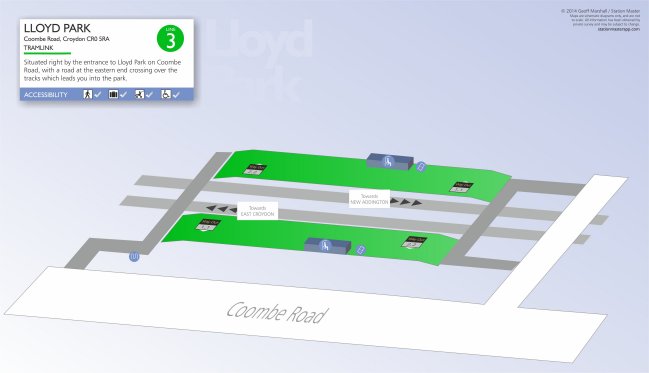
It didn’t stop us knocking together a quick 3D Map of the Lloyd Park stop, just to see what it would be like – done in the correct ‘Tramlink Green’ colour, of course …

Lloyd Park Tramlink 3D Map

Lloyd Park Tramlink 3D Map