A lot of people ask us ‘How do you draw your 3D maps of the stations?’ and when we give them details of what software we use they say ‘No, no!’ as they mean how do we know how to draw them?
It’s because we go to each station in turn – with a notebook – and draw out a rough sketch of what its’s like, and then if we have to – go back and visit it again and fill in any details we might have missed and check that we’ve got it right.
We’re down to the last few maps to do (there are less than 10 left for us to draw to have completed all 270 tube stations) and one of the last tricky ones is Stratford! It’s got to be the most complicated station on the whole network, with two Tube lines, National Rail, The Overground and two different branches of the DLR all coming together.
And here’s how it looks in the very early stages of us designing it and putting it together. It’ll take a while, but it will be done!
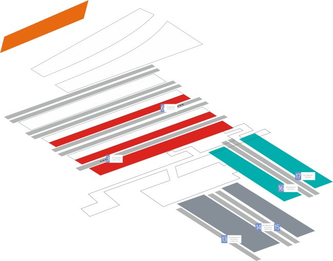
Stratford 3D Map